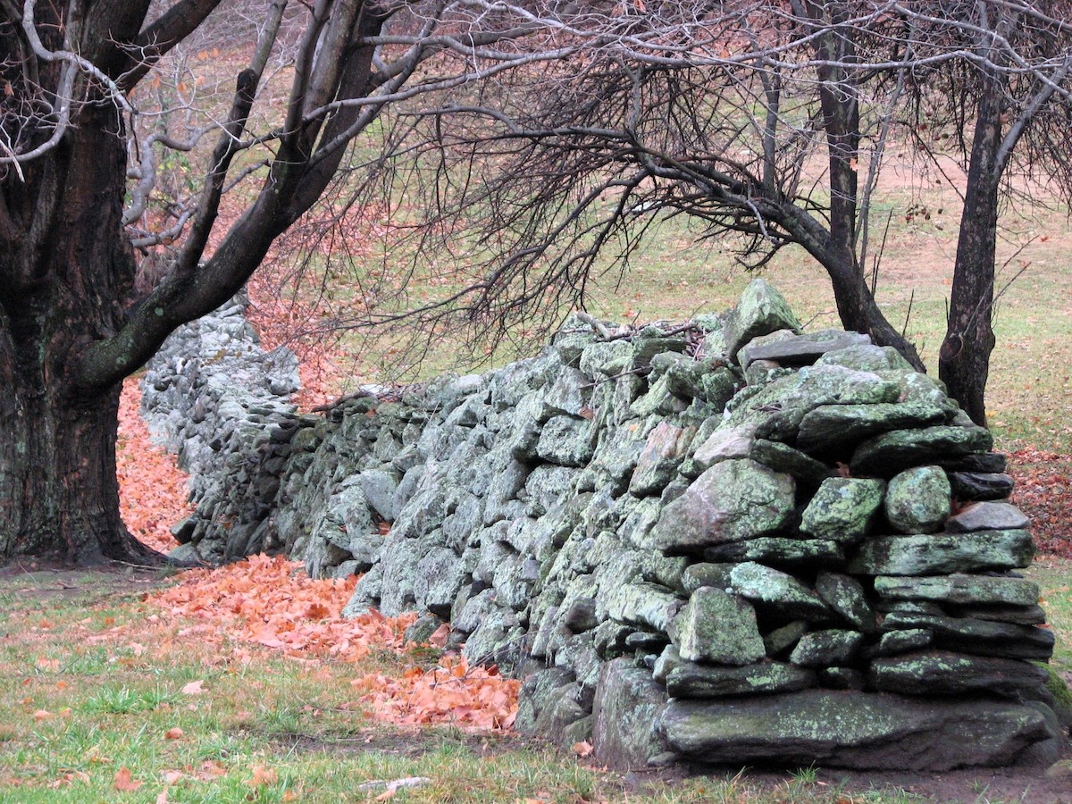
Photo of a historic stone wall, probably in Glastonbury, Connecticut. For inventory purposes, this would be a single segment of an uncapped, single-tiered, un-coursed, double wall with a re-built termination. Aside from being an aesthetic and archaeological resource, this wall is also a dryland habitat and an ecological barrier, corridor, and partitioner. Courtesy of Paul Ramsey.
In Spring 2025, The Stone Wall Initiative is ramping up its activities with a series of events, projects, and talks based the recent article Conserving the Historic Stone Walls of New England, which was published in the peer-reviewed scholarly journal The Public Historian in February 2024. As of this posting on April 4, 2025, historical societies, conservation organizations, land trusts, environmental non-profits, garden clubs, and town planners in Ashford, Mansfield, Litchfield, Stonington, Lyme, and Sherman, Connecticut, in Cumberland and Little Compton, Rhode Island, and at Quabbin Reservoir in Massachusetts are working with me to help implement A Stepwise Coordinated Plan for Stone Wall Conservation. This last link will take you to an article of title by staff writer Elaina Hancock in the University of Connecticut’s online magazine UConn Today. In it, she provides a concise review of the Public Historian article as a good first-read for anyone wanting to jump start the process.
It’s one thing to talk about stone wall conservation in general, which this website has been doing for decades, and which I have most prominently featured in the New York Times and the Smithsonian. It’s quite another to get down to the nitty gritty of managing them on private, trust, town, state, federal, and Indigenous lands. This takes the commitment, time, and a budget of organizations
Four recent events have made conservation of walls more efficient, more objective, and more important.
- Within a designated GIS layer for the Stone Domain, a top-down map of stone features based on LiDAR technology can be combined with bottom up inventories from known historic sites.
- The recently published Taxonomy and Nomenclature of the Stone Domain provides a peer-reviewed and vetted classification for an inventory of stone features.
- Increased attention to Indigenous stone features requires that the broader context of Euro-settlement features be known from inventory, and
- Increased attention to walls as dryland habitats equivalent in principle to their counterparts of wetland habitats.
Once in place, a GIS layer for the Stone Domain provides solid ground for management, ultimately for the benefit of conserving these irreplaceable historic and ecologic resources for future generations.
If you would like to discuss how to proceed, just contact the SWI via robert.thorson@uconn.edu.